SpyTHINK 019: Amelia Earhart's Fatal Aerial Spy Mission in 1937

Seaplanes are better than Land Planes when Crossing Oceans--AE didn't get the memo!
The Amelia Earhart (AE) Mystery is SOLVED as in there are only 4 distinct causation possibilities; a self-indulgent not-needed global flight around the equator or an excuse for the FDR administration to prepare a future military base on Howland island or AE/FN pretending to get lost so their searchers would have excuses to over-fly Japanese-held islands and spy camera photograph them for impending U.S. participation in WW2 or AE/FN pretending to be lost and spying on Japanese bases with hidden spy cameras in their Electra twin. Either AE and Fred Noonan (FN) were Incompetent or Competent to perform these 4 mission tasks. All of these tasks could be combined if overlap was wanted.
REALITY CHECK: WW2 WAS ALREADY UNDERWAY IN 1937; Japan invaded and occupied a huge chunk of China beginning in 1931.
The effective outcomes are also only 4 with the last happy ending with 2 distinct possibilities but all 4 are mutually exclusive branches in the tree and cannot be combined. They are upsetting so brace yourself--either they were Abandoned & Starved or Crashed to Death (ASCD) or Japanese Captured & Executed (JCE) or Rescued, Betrayed & Murdered (RBM) or Recovered and Returned (RR) to civilization either in Hiding for ever (H4EVR) or back to famous public limelight (FPL). We know FPL did NOT happen.
Amelia Earhart & Fred Noonan Disappearance Logical Wire Diagram
CAUSE EFFECT
MISSION--------------------------------SKILLS
Selfish Plane Tour (SPT) Incompetent ASCD (Lack of Seaplane/SERE)
Competent
GeoAssertion Excuse (GAE) JCE (Not take enemy seriously)
Lost Searchers Spy Cameras (LSSC) RBM (JAD-like Dirty Tricks)
Lost Spy Camera Overfly (LSCO) RR
Hiding 4 Ever
TELLS
Why not use a SEAPLANE instead of land plane to circum-navigate the world at the Equator? Noonan was instrumental in setting up PAN AM seaplane airliner routes....if seaplane can't find dry land or has mechanical troubles, put down in water, conserve fuel and scoot like a duck to safety/rescue etc.
Why a land plane in great jeopardy over the water when a seaplane would have been safer??
Why didn't AE/FN fly to Fiji or the main grouping of the Phoenix islands--say Kanton island--which are much easier to spot from the air than Howland island needing a runway built there and refuel supplies/personnel staged there?
Why not set-up a runway & refueling stop THERE in Fiji or the closely-grouped-together, Phoenix islands jointly owned by the U.K./USA?.
Why hard-to-spot, Howland island instead?
WHY the re-do flight going in the opposite direction after the suspicious ground loop?
Because if they flew from Hawaii to Howland--they'd already have found the difficult landing spot and would then have no excuse to wander or get lost going into the giant New Guinea land mass. However, changing direction would post-pone the hardest leg with no air navigation land mark back stop!
THIS GIVES THE GAME AWAY.
Read the history of Kanton & Howland islands below.
A PERFECT EXCUSE TO FLY THROUGH THE GILBERT ISLANDS AND TAKE PHOTOS OF THE JAPANESE USING HIDDEN CAMERAS like British RAF photo recon expert Sidney Cotton would do over Nazi Germany in an Electra in 1939? Cotton was close friend of Commander Ian Fleming of Naval Intelligence.

www.combatreform.org/airrecon.htm
Last Plane Out of Berlin by Jeffrey Watson
https://www.dailymotion.com/video/x3lzr96
https://en.wikipedia.org/wiki/Sidney_Cotton
Cotton went back to England to join the Royal Naval Air Service in November 1915. After only five hours solo flying, he qualified as a combat pilot, and initially flew Channel patrols. Cotton went on to participate in night bombing sorties over France and Germany with Nos 3 and 5 Wings. His experience with high level and low-temperature flying led Cotton in 1917 to develop the revolutionary new "Sidcot" suit, a flying suit which solved the problem pilots had in keeping warm in the cockpit.[N 1] This flying suit was widely used by the RAF until the 1950s. Cotton continued with No. 8 Squadron RNAS in 1917 where he was promoted to Flight Sub-Lieutenant in June 1917. Soon after, he came into conflict with senior officers, and resigned his commission in October 1917.[3]
Shortly before the Second World War, Cotton was recruited by Fred Winterbotham (then of MI6) to take clandestine aerial photographs of the German military buildup. Using his status as a wealthy and prominent private aviator currently promoting his film business (and using a series of other subterfuges including taking on the guise of an archaeologist or a film producer looking for locations), a series of flights provided valuable information about German naval activity and troop build-ups. He equipped the civilian Lockheed 12A business aircraft, G-AFTL, with three F24 cameras concealed behind panels which could be slid aside and operated by pressing a button under the pilot's seat, and a Leica behind a similar panel in the wings. Warm cabin air was diverted to prevent condensation on optical surfaces. Cotton took his secretary Patricia Martin along, and she too took photographs in flight. Although his flight plans were dictated by the German government, he consistently managed to get away with flying off-track over military installations. Cotton had a very persuasive manner, and exploited any advantage he could.[3]
In 1939, Cotton took aerial photos during a flight over parts of the Middle East and North Africa. On the eve of war, he even managed to engineer a "joy-ride" over German military airfields on one occasion, accompanied by senior Luftwaffe officer Albert Kesselring. With Kesselring at the controls, Cotton reached under his seat, operated the cameras, and captured the airfield on film. Cotton later offered to fly Hermann Göring to London for talks a week before outbreak of hostilities, and claimed that his was the last civilian aircraft to leave Berlin before the outbreak of hostilities. One biography is titled Sidney Cotton: The Last Plane Out of Berlin commemorating this escapade.
Second World War
Appointed as a Squadron Leader and honorary Wing Commander on 22 September 1939, in the same period, Cotton was recruited to head up the fledgling RAF 1 Photographic Development Unit (PDU) at Heston Aerodrome. This unit provided important intelligence leading to successful air raids on key enemy installations.[4] With his experience and knowledge gained over Germany and other overflights, Cotton greatly improved the RAF's photo reconnaissance capabilities. The PDU was originally equipped with Bristol Blenheims, but Cotton considered these quite unsuitable, being far too slow, and he consequently "wheedled" a couple of Supermarine Spitfires. These Spitfires, later augmented by de Havilland Mosquitos, were steadily adapted to fly higher and faster, with a highly polished surface, a special blue – "PRU Blue" – camouflage scheme developed by Cotton himself, and a series of modifications to the engines to produce more power at high altitudes. In 1940, Cotton also personally made another important reconnaissance flight with his Lockheed 12A over Azerbaijan via Iraq as part of Operation Pike.
Under his leadership, the 1 PDU acquired the nicknames, "Cotton's Club" or the less flattering "Cotton's Crooks" (mainly due to Cotton's propensity to flout regulations). Cotton revelled in his reputation as unorthodox, and even had a special badge struck bearing the initials "CC-11" that signified the 11th commandment – "Thou shalt not be found out."[5]
Cotton's aerial photographs were far ahead of their time. Together with other members of the 1 PDU, he pioneered the techniques of high-altitude, high-speed stereoscopic photography that were instrumental in revealing the locations of many crucial military and intelligence targets. R.V. Jones recounts in his memoirs how these photographs were used to establish the size and the characteristic launching mechanisms for both the V-1 flying bomb and the V-2 rocket. Cotton also worked on ideas such as a prototype specialist reconnaissance aircraft and further refinements of photographic equipment.
By mid-1940 however, Cotton had clashed with senior officials in the Air Ministry over his participation in the evacuation of British agents from France under the cover name of "Special Survey Flights." After his return from France couriering Marcel Boussac, the head of the Christian Dior garment and perfume empire, for a fee, he was removed from his post and banned from any involvement with air operations.[5] Following several efforts to be reinstated, even involving Churchill himself, Cotton resigned his commission; he was nevertheless appointed an OBE.[6] For the remainder of the war, Cotton acted as an unofficial consultant to the Admiralty. Under the new designation, 1 Photographic Reconnaissance Unit (PRU), based at RAF Benson, 1 PRU went on to a distinguished wartime record, eventually operating five squadrons out of a number of bases. Succeeding commanding officers would emulate the spirit and innovative techniques pioneered by Cotton.
PIC: Sidney Cotton's postwar Lockheed 12A
In September 1940, Cotton's modified Lockheed 12A (G-AFTL), was severely damaged in an air raid at Heston Aerodrome. It was rebuilt by Lockheed, sold in British Honduras, and in 1948 registered in the US as N12EJ; the aircraft resided in Florida in 1992.[7] His postwar Lockheed 12A (G-AGTL) also survives in France in 2005.
In September 1940, Cotton pursued the idea of an airborne searchlight for night-fighters, that he termed "Aerial Target Illumination" (ATI). He enlisted the help of William Helmore, and they jointly took out patents on the techniques (GB574970 and GB575093). Helmore, a serving RAF officer, then sponsored the development of what became known as Turbinlite.[8][9]
****
The AE/FN mission smacks of standard, REVERSE military planning--decide your end state--then work backwards from there to justify it. Just like the Dulles CIA needed JFK in Dulles, Texas in Dealey Plaza to fall victim to their multiple gunmen ambush.
combatreform.org/THEJFKRESEARCHSITE
However, AE/FN screwed up and didn't make it to Howland island and then either could not be allowed to be "rescued" and the cameras found out--so FDR deliberately abandoned them while going-through-the-motions of finding them or worse the Imperial Japanese Navy (IJN) did find and kidnapped them.
Why didn't AE radio her geolocation for the next 6 days as a civilian plane crew would???
Guilty Demeanor: because she didn't want to help the Japanese find them.
DISCUSSION

Civilian Normie Art Work Omits the Japanese-held Islands They flew Through
The AE/FN global flight began as a SPT for sure, but...the absurd change of direction TELL means it was kept on as world cover story with USG mission(s) superseding it. The preponderance of evidence points to the LSSC/LSCO missions because they both need finding-Howland-Island-difficulty as a ready-made excuse; SPT and GAE missions could be done by easily flying to Howland from Hawaii 1st. 5 years after the likely tragedy, AE's husband George Putnam and best aviatrix friend, Jackie Cochrane pushed for a Hollywood movie offering the LSSC explanation to redeem her pilot reputation tarnished by SPT/incompetence sheeple ass u mptions now that America's WW2 was underway and the intelligence collected had worked. An unpleasant thought is did the 1943 movie get AE/FN executed if still alive and in Japanese captivity?

FDR wanting to get an additional goal of making Howland island into an air base seems a given and is what actually happened--enough of a motive to risk 2x lives, no.
IMHO, both AE and FN were dangerous-to-their-own-survival incompetent. Aviator flight from comfy air base runway to comfy air base runway is what civilian normie sheeple want--and finally got--but its severe arrogance and disrespect for The Battle Against the Earth (TBATE). PAN AM did Pacific ocean routes by SEAPLANES that can land on the water in case of Pilot, Engine, Airframe (PEA) failure and/or bad weather. Remember Indiana Jones flying by PAN AM seaplanes? AE/FN not using a sleek seaplane with a PLAN B ability to water land and then conserve fuel and scoot like a wounded duckling aka boat to safety--all the while radioing SOSes is the height of incompetence. I don't buy the normie landplane fangirl BS that a plane without a boat hull shape & floatation was somehow AOK because of empty fuel tanks to stay afloat while all around is leaking. A SEA-WORTHY seaplane was/still is needed. This shape can be just as streamlined as a land plane or even better as the Martin P6M SeaMaster proved--so don't even go there with normie craptalk of land planes being more flight performance capable yadda yadda not true. This is a LIE from dry land plane maker/racketeers.
https://www.youtube.com/watch?v=QowTqmxYZ1Q
This is true to the present day. Noonan was an excellent navigator--but an alcoholic who tolerated a crappy arrangement in the Electra such that he couldn't functionally shoot position fixes--some ASCD theorists insist a minor off-course error of 20 miles and getting worse & worse as they flew along when visibility was only 40 miles at low altitude doomed them to missing Howland island. The survival gear they carried--a lifeboat AFAIK no solar still for making sea water into drinking water is infuriating when such things were available. Because AE/FN were incompetent I am disinclined to think the USG would have them do the LSCO mission--but I could be wrong. The Cotton Electra LSCO methodology did happen shortly therafter over Europe.
FDR land-grabbing Howland island to make it an airfield with runway is an easy additional goal to add to SPT--but doesn't explain the weird un-necessary main flight direction change from east-to-west from Hawaii to west-to-east all across the globe. This 180 U-TURN can only be understood as a reverse military planning consequence of wanting AE/FN to get plausibly lost flying across the Japanese mandate islands towards difficult-to-find Howland island. Depending on how incompetent AE/FN were, THEY MUST HAVE LANDED ON A DRY PART OF AN ISLAND such that their landing gear held the plane up for her to transmit for 6 days with engine or engines/props running. That they didn't have a hand-crank emergency 2-way radio with kite to hold up its antennae for maximum signal reach is intolerable to accept. Such things existed in 1937. The civilian normie pilots club, International Group for Historic Aircraft Recovery (TIGHAR) wasting $$$ millions taking vacations to Nikomorowhatever island should instead by looking at EVERY ISLAND WITHIN THE ELECTRA'S FUEL RANGE REACH after last verified transmission with an eye towards a wheels-down landing effected. Its similar to what should be done to geolocate Flight 19's 5x TBM Avenger planes in the Bermuda Triangle.
https://www.youtube.com/watch?v=aYLkVHvkKew
Once on the marginal dryish land, AE/FN had minimal food/water supplies with no way to COLLECT MORE. This is unsat and enrages me, frankly.

AE/FN's Survival Supplies: NOT MUCH.
We know AE was alive for at least 6 days after last in-flight transmission. FN appears to have been seriously wounded in the landing and may have died?. The evidence that AE/FN were captured by the Japanese explains why she didn't transmit her geolocation in her 6 days of transmissions which otherwise should have been: SOS. Position. SOS position. SOS position. Listeners would realize WHO was asking for rescue DUHHH--maybe not today's 20-somethings...The America search planes launched from the battleship Colorado and aircraft carrier Lexington were snapping pics away at the Japanese-held islands for future military operations--it was indeed a military success.
What happened to AE/FN is not so pretty and is frankly disgusting. If you factor in the evidence of 2x shallow graves on Saipan reported by a credible U.S. ARMY Soldier, than the Japanese found them, captured and then executed them--WAR CRIMES that cannot be dismissed. If their Electra plane didn't have smoking gun spy cameras on board, then its too damn bad they were used as decoys/excuses for the U.S. Navy planes that had them. The American people should demand Japanese military intelligence scour its files for evidence of JCE of AE/FN. Lack of paper trail DOES NOT mean it didn't happen 20-something normies who don't-know-shit-about-real-world-life.
If the above were not disturbing enough, the RBM possibility rears its ugly head.
I was friends with British Spy/Assassin/Commando John Ainsworth-Davis (JAD) pen name Christopher Creighton who worked under PINEWOOD TV/movie cover after WW2 like the other Old Vic Academy actors; British Army Captains Sir Roger Moore and Christopher Lee, Royal Navy small fast boat, captain & navigator, LT Patrick MacNee, Lois Maxwell--all of the James Bond book/movie PR campaign for the Information Research Division (IRD) of MI6-SIS by Master Spy, Commander Ian Fleming. I wrote a book about this, James Bond is REAL in 2011. I also have extensive correspondence with JAD's WW2 fictionally-flavored bio, The Paladin's co-author, the brilliant Brian Garfield of Hollywood Death Wish movie series fame. Garfield's book on the importance of the Japanese invasion of Alaska depriving them of 2x aircraft carriers needed at the Battle of Midway is also a must-read. Before passing, JAD had me help him publish his fiction-removed bio, The Mountbatten Report with Bormann Nazi hunter Laurence DeMello which ends just as Operation JAMES BOND, OPJB: The Last Great Secret of World War Two begins detailing how Fleming and him led British Commandos to Berlin to extract Bormann in 1945.
https://www.youtube.com/watch?v=G6z2Cm5mRdk
The unpleasant reality is POTUS FDR and U.K. Prime Minister Winston Churchill knew that for the free world to survive the high-technology German Nazis who were working on the atomic bomb Weapon of Mass Destruction (WMD) and Anti-Gravity Craft (AGC), America would have to be clearly attacked by Axis partner Japan to get the pacifistic American sheeple into the war before it was too late.
combatreform.org/black_sun.htm
Clearly, FDR & Churchill baited the Japanese to attack the American fleet by moving it to Pearl Harbor, Hawaii from distant San Diego. Everyone's militaries studied how to attack Pearl Harbor for years leading up to the actual event. The Japanese codes were broken; we read their mail and knew they were coming to Pearl Harbor. A Dutch submersible periscope detected the IJN fleet approaching Pearl Harbor--but JAD was ordered to rendezvous by submarine to congratulate them by killing them to silence them forever. No one would brag about such murdering if it were not true. JAD also murdered other key witnesses of the Dutch submarine's warnings including a woman. Ugggh. FDR/Churchill clearly thought like the latter's Master Spy, Desmond Morton that these "loose end" people could not be trusted to shut up or could be imprisoned for the war. After the war...just one tell-all book could collapse the entire social contract of the powers-that-be (PTB) with the sheeple who can't handle such truths.
Let me surprise you and say I agree that the Japanese had to be baited to attack Pearl Harbor to get Nazi Germany to declare war on America in time, though I think the witnesses of the IJN's approach could have kept quiet by imprisonment at a secluded locale until such time passed that normies wouldn't believe them. Sort of like the CIA's stall tactics with their group ambush murder of POTUS JFK. Today, Americans don't-give-a-shit about JFK, RFK or even black hedonists about MLK which Coretta Scott King and family proved the USG murdered the latter in federal court. Their flat screen TVs are all that matters.
If I had known to ask him before he passed, I would have asked JAD directly about AE/FN. My bad.
In light of all of the above in Greatest Common Denominator (GCD) methodology, its entirely possible the U.S. Navy quickly found AE/FN, recovered their plane with or without film cameras and betrayed their trust and MURDERED THEM to keep them silent of the whole affair.
Certainly, immoral hedonist U.S. marines would have eagerly murdered AE/FN if ordered to do so--such malignant narcissists today threaten the American nation's existence by constant military incompetence and easily used by the DEEP STATE Illuminati as pawns in their myriad of criminal rackets and scams.
In the case of RBM, there would be no bodies or much Electra airplane to find as the USN/Mc would have disposed of them all.
There are only 2 remaining "happy ending" possibilities for AE/FN which I sincerely hoped "would a could a" happened; the USG in good faith and likely competence rescued them after 6 days and returned them to America to live the rest of their lives in hiding (H) or returning to public famous person limelight (FPL). However, we know for a fact, they did not return to America as famous heroes and survivors of the fakeola SPT; so scratch-off FPL.
Sad, but true.
This leaves the USG changing AE/FN's identity papers (Gestapo officer: "Papers please! we must see your papers!") and them going into hiding thereafter. Its either that--or a bullet into their heads. Such an arrangement would have to be offered up-front or as a fait accompli after the inexperienced-with-spy-antics, AE/FN found themselves in Pacific ocean water over their heads--literally & figuratively.
Could female narcissist--the famous aviatrix, AE accepted starting her life over as an anonymous person? FN, I could see doing this bribed by running an aviation navigation school in some remote-from-public-scrutiny location--say for the British instigated by Sir William Stephenson aka The Man Called Intrepid?.The fabulous OSS didn't exist in 1937 so British Security Coordination (BSC) or MI6-SIS help would be needed.
The web article below of a house wife resembling AE shouldn't be dismissed just because its juxtaposed with bullshit UFO/ET abduction thrown in by some smart ass to discredit the entire inquiry.
Could there be an USG paper trail of AE/FN that could be FOIA found? Certainly--if the old trick of misplacing files away from their subject headings game isn't in effect in the National Archives aka NARA. I'd FOIA AE/FN, OSS, FBI, BSC, MI6-SIS, CIA etc. and see what falls from FOIA shaking the tree. If JCE is what happened, the USG should have known about it and betrayed them by doing nothing to get them back. If they did bargain for them they'd have to H4EVR thereafter. Similar situation as the USAF C-124 Globemaster II pax/crew in 1951 and KAL 007 airliner shoot-down survivors in 1983 all captured by Soviet Communist Russians.
https://www.youtube.com/watch?v=fWES7ojTqNA
POSSIBILITY A1: AE--famous aviatrix lost--as excuse for searchers with cameras--to fly over Japanese-held islands.
The least help request from AE/FN would be just to get themselves plausibly "lost" and have the U.S. military (USMIL) searchers do the overflight aircraft camera spying. FOIA requests for the log books of the CG cutter Itasca, USS Colorado and Lexington might stumble onto some reveals. There was adequate time to fit cameras to aircraft especially if already configured as recon planes.
https://en.wikipedia.org/wiki/Flight_for_Freedom

I love her "twin engines"!
Flight for Freedom was produced by RKO, whose CEO, Floyd Odlum, was married to Jacqueline Cochran, one of Earhart's close friends and a renowned aviator in her own right. It was claimed to be based on a screenplay submitted by Amelia Earhart's husband, George P. Putnam.[5] Rosalind Russell's characterization of the Earhart-like aviator shows Carter establishing a reputation as "the Lady Lindbergh" and setting numerous aviation records. Other characters are loosely drawn from real life, such as Earhart confidant and instructor Paul Mantz, as well as Fred Noonan, albeit in the role of pilot Randy Britton, played by Fred MacMurray, on loan from Paramount Pictures.
Principal photography, under the working title Stand to Die, was completed from late-August to late-October 1942, with additional scenes shot in December, as the release was held back to coincide with the headline news surrounding the Battle of Midway. Newsreel footage was incorporated to show naval missions over the area that Tonie Carter was portrayed as having overflown.[6]

Roz would fit into today's fashion no problemo!
Flight for Freedom furthered a belief that Earhart was spying on the Japanese in the Pacific at the request of the Franklin Roosevelt administration.[7][Note 1] Bosley Crowther of The New York Times, in his contemporary review, echoed the popular notion that the film was based on the life of Amelia Earhart. His lukewarm review touched on the central theme as being provocative. His review noted: "As a movie, this 'Flight for Freedom' bumps along interminably before it lifts, mainly because it has trouble pulling out of a conventional rut. Mostly it is a routine story of one of those unsatisfactory romances, wherein a woman flier and a gentleman (also a flier) stay apart. He is a reckless, wolfish rascal; she is a steady, four-square type. While she is becoming famous he is becoming a bum. But then the Navy secretly invites her to join in a ruse upon the Japs. For one brief moment before oblivion she meekly acknowledges her love."[9]
^ Cochran 1954, p. 160.
https://en.wikipedia.org/wiki/Fred_Noonan
Frederick Joseph "Fred" Noonan (born April 4, 1893 – disappeared July 2, 1937, declared dead June 20, 1938) was an American flight navigator, sea captain and aviation pioneer, who first charted many commercial airline routes across the Pacific Ocean during the 1930s. Navigator for Amelia Earhart, he was last seen in Lae, New Guinea, on July 2, 1937, on the last land stop before they disappeared somewhere over the Central Pacific Ocean, during one of the last legs of their attempted pioneering round-the-world flight.
At the age of 17, Noonan shipped out of Seattle as an ordinary seaman on a British sailing bark, the Crompton. Between 1910 and 1915, Noonan worked on over a dozen ships, rising to the ratings of quartermaster and bosun's mate. He continued working on merchant ships throughout World War I. Serving as an officer on ammunition ships, his harrowing wartime service included being on three vessels that were sunk from under him by U-boats.[4] After the war, Noonan continued in the Merchant Marine and achieved a measure of prominence as a ship's officer. Throughout the 1920s, his maritime career was characterized by steadily increasing ratings and "good" (typically the highest) work performance reviews. Noonan married Josephine Sullivan in 1927 at Jackson, Mississippi. After a honeymoon in Cuba, they settled in New Orleans.
Navigator for Pan Am
Following a distinguished 22-year career at sea, which included sailing around Cape Horn seven times (three times under sail),[4] Noonan contemplated a new career direction. After learning to fly in the late 1920s,[4] he received a "limited commercial pilot's license" in 1930, on which he listed his occupation as "aviator." In the following year, he was awarded marine license #121190, "Class Master, any ocean,"[3] the qualifications of a merchant ship's captain.[5] During the early 1930s, he worked for Pan American World Airways as a navigation instructor in Miami and an airport manager in Port-au-Prince, Haiti, eventually assuming the duties of inspector for all of the company's airports.
In March 1935, Noonan was the navigator on the first Pan Am Sikorsky S-42 clipper [seaplane] at San Francisco Bay. In April he navigated the historic round-trip China Clipper flight between San Francisco and Honolulu, piloted by Ed Musick (who was featured on the cover of Time magazine that year). Noonan was subsequently responsible for mapping Pan Am's clipper routes across the Pacific Ocean, participating in many flights to Midway Island, Wake Island, Guam, the Philippines, and Hong Kong. In addition to more modern navigational tools, Noonan as a licensed sea captain was known for carrying a ship's sextant on these flights.
1937 was a year of transition for Fred Noonan, whose reputation as an expert navigator, along with his role in the development of commercial airline navigation, had already earned him a place in aviation history. The tall, very thin, dark auburn-haired and blue-eyed 43-year-old navigator was living in Los Angeles. He resigned from Pan Am because he felt he had risen through the ranks as far as he could as a navigator, and he had an interest in starting a navigation school. In March, he divorced his wife Josephine in Ciudad Juárez, Mexico. Two weeks later, he married Mary Beatrice Martinelli (born Passadori) of Oakland, California. Noonan was rumored to be a heavy drinker. That was fairly common during this era and there is no contemporary evidence Noonan was an alcoholic, although decades later, a few writers and others made some hearsay claims that he was.[6][7]
Earhart world flight and disappearance
Amelia Earhart met Noonan through mutual connections in the Los Angeles aviation community and chose him to serve as her navigator on her World Flight in the Lockheed Electra 10E that she had purchased with funds donated by Purdue University. She planned to circumnavigate the globe at equatorial latitudes. Although this aircraft was of an advanced type for its time, and was dubbed a "flying laboratory" by the press, little real science was planned.

Pan Am Clipper Routes NORTH of the Japanese-held Mandate Islands hmmmm....
The world was already crisscrossed by commercial airline routes (many of which Noonan himself had first navigated and mapped), and the flight is now regarded by some as an adventurous publicity stunt for Earhart's gathering public attention for her next book.[8] Noonan was probably attracted to this project because Earhart's mass market fame would almost certainly generate considerable publicity, which in turn might reasonably be expected to attract attention to him and the navigation school that he hoped to establish when they returned.
The first attempt began with a record-breaking flight from Burbank, California, to Honolulu. However, while the Electra was taking off to begin its second leg to Howland Island, its wing clipped the ground. Earhart cut an engine off to maintain balance, the aircraft ground looped, and its landing gear collapsed. Although there were no injuries, the Lockheed Electra had to be shipped back to Los Angeles by sea for expensive repairs. Over one month later, they tried starting again, this time leaving California in the opposite (eastward) direction.
Earhart characterized the pace of their 40-day, eastward trip from Burbank to New Guinea as "leisurely". After completing about 22,000 miles (35,000 km) of the journey, they took off from Lae on July 2, 1937, and headed for Howland Island, a tiny sliver of land in the Pacific Ocean, barely 2,000 meters long. Their plan for the 18-hour-long flight was to reach the vicinity of Howland using Noonan's celestial navigation abilities and then find Howland by using radio signals transmitted by the U.S. Coast Guard cutter USCGC Itasca.
Through a combined sequence of misunderstandings or mishaps (that are still controversial), over scattered clouds, the final approach to Howland Island failed, although Earhart stated by radio that they believed they were in the immediate vicinity of Howland. The strength of the transmissions received indicated that Earhart and Noonan were indeed in the vicinity of Howland island, but could not find it and after numerous more attempts it appeared that the connection had dropped. The last transmission received from Earhart indicated she and Noonan were flying along a line of position (taken from a "sun line" running on 157–337 degrees) which Noonan would have calculated and drawn on a chart as passing through Howland. Two-way radio contact was never established, and the aviators and their aircraft disappeared somewhere over the Central Pacific Ocean. Despite an unprecedented, extensive search by the U.S. Navy—including the use of search aircraft from an aircraft carrier—and the U.S. Coast Guard, no traces of them or their Electra were ever found.[N 1]
Later research showed that Howland's position was misplaced on their chart by approximately five nautical miles. There is also some motion picture evidence to suggest that a belly antenna on their Electra might have snapped on takeoff (the purpose of this antenna has not been identified, however radio communications seemed normal as they climbed away from Lae).[10][11] One relatively new theory suggests that Noonan may have made a mistake in navigation due to the flight's crossing of the International Date Line.[12] However, this theory is based entirely on supposition and does not offer any evidence Noonan was impacted by or failed to adequately account for the 24-hour variance in his sun line calculations.
The USS Lexington, a large aircraft carrier, and the USS Colorado, a battleship, the [Coast Guard] Itasca, and even two Japanese ships searched for seven days, covering 150,000 square miles (390,000 km2) of ocean and the few islets. The official search for them by a variety of vessels lasted until July 18, 1937, a total of 16 days.[9]
****
I make LSSC the top possibility because making a Hollywood movie just 5 years after the AE mystery suggests reassuring the public--which implies an USG-sanctioned, LIMITED HANG-OUT of the up to that point, hidden facts from INSIDERS like hubby Putnam & gal pal Cochrane. Maybe if there were hidden cameras for spy overflights were too much sources & methods details for 1943 and not part of the limited hang-out? Stoical Chet Huntley playing of course a news broadcaster and Hugh Beaumont father in TV's "Leave it to Beaver" plays a flight instructor--both very moral men; them participating in the film suggests some inherent validity.
https://www.imdb.com/name/nm0403142/bio?ref_=nm_ov_bio_sm
Chet also participated in historical events, such as November 22, 1963, when, along with stunned colleagues Bill Ryan and Frank McGee, he brought to NBC viewers live coverage and instant analysis of the events surrounding the assassination of President John F. Kennedy.
"Flight to Freedom"

Yummy.
https://www.imdb.com/title/tt0035888/
Fictionalized biography of Amelia Earhart (here called Tonie Carter). First, a flag-waving preface about air warfare in the Pacific; then flashing back to her first solo flight in 1932; whirlwind romance with sexist ace pilot Randy Britton; advanced training; a transcontinental race; world fame; first, aborted round-the-world flight; and her famous disappearance. This film popularized the theory that Earhart's disappearance was connected with secret work for the U.S. Navy. Written by Rod Crawford <puffinus@u.washington.edu>
FULL MOVIE
https://ok.ru/video/315095059107
Discussion of flying over the Japanese mandated islands begins at 58:00. Sexy film noire' until then.

Admiral Graves: "They won't let tourists in" [like OSS agent, Moe Berg as a major league ball player visiting Tokyo and covertly filming there...]
"We have to find an excuse which the Japs will accept"
1:05: 00 Admiral Graves' mission pitch to world-famous aviatrix Carter played by sexy-breasty Rosalind Russell.
"From Lae, New Guinea...somewhere between New Guinea and Hawaii islands you get yourself in trouble. You radio a distress call which will be flashed across every front page in the world. You admit your calculations were off and your gasoline is running low. Another frantic call for help--then--silence. You land on that tiny speck right there (points on a map) Gull island its nothing more than a coral reef we'll see its stacked with provisions--you'll stay in reasonable comfort until the Navy comes to take you off. As far as the world knows you're lost. They'll be a widespread search for you. World public opinion will demand it. That search will include the Japanese mandated islands-and Japan will not dare to interfere because we are looking for you. The world's greatest woman flying. And during that search we'll photograph every square mile of those islands. Then when war comes we'll be able to defend ourselves against attack strike back at the nerve centers of their Empire"
Later on in a Lae hotel.
LT. Randy Britton: "It ain't gonna be an easy job finding that hunk of coral even in good weather. Unless we have perfect visibility ehh, never mind that...let me do the worrying".
Unfortunately, the hotel manager in Lae (Richard Loo) reveals he's a Japanese spy and knows their entire plan.
To protect Britton from the enemy ambush, Carter takes off without him.

Where's Bugs Bunny & the Gremlin?
Carter commits hypoxia suicide to establish the cover story to get the search/spy actions--but without following the compromised plan of landing on Gull island and being immediately detected by the Japanese.
https://en.wikipedia.org/wiki/South_Seas_Mandate

Following the initial Japanese occupation of the islands, a policy of secrecy was adopted. Japan made it plain that it did not welcome the entry of foreign ships into Micronesian waters, even those of its wartime allies. During the first five years that Japan occupied the islands, it consolidated its presence and the islands became a virtual Japanese colony. The Imperial Japanese Navy divided the territory into five naval districts in Palau, Saipan, Truk, Ponape, and Jaluit Atoll, all reporting to a rear admiral at the naval headquarters at Truk.[7]
A proposal at the Versailles Conference to allow trade and migration between those islands to be administered by Japan and those to be administered by Australia and New Zealand was rejected. Japan was able to continue administering the islands as if they were colonial possessions, keeping their waters off-limits to foreigners.[7] When the islands became legally a League of Nations Mandate, Japan administered them as Japanese territory and as part of the Japanese Empire. This situation continued even after Japan withdrew from the League of Nations in 1935 and lost its legal claim to administer the islands.[11]
PIC: Headquarters of the government of the South Seas Mandate in Saipan
Militarily and economically, Saipan, in the Marianas archipelago, was the most important island in the South Seas Mandate[12] and became the center of subsequent Japanese settlement. The towns of Garapan (on Saipan), Koror (on Palau) and Colony (on Ponape) were developed to resemble small towns in Japan, with cinemas, restaurants, beauty parlours and geisha houses.[13] Another important island was Truk in the Carolines archipelago, which was fortified into a major navy base by the Imperial Japanese Navy.[11]
PIC: Native Micronesian constables of Japanese Truk Island, circa 1930. Truk became a possession of the Empire of Japan under a mandate from the League of Nations following Germany's defeat in World War I.[14]
Between 1914 and 1920 the islands began the slow transition from naval to civilian administration. By 1920 all authority had been transferred from the Naval Defense Force to the Civil Affairs Bureau which was directly responsible to the Navy Ministry. Initially based in Truk, the Civil Affairs Bureau was moved to Koror in the Palau islands in 1921. The naval garrisons were disbanded to comply with the terms of the Mandate.[7] In April 1922 a civilian government was established in each of the six administrative districts (Saipan, Palau, Yap, Truk, Ponape and Jaluit)[15] in the form of a civil administration department which still reported to the local naval garrison commander.[citation needed] At the same time, a post of Governor of the South Seas Mandate was created. Governors were mostly admirals or vice-admirals as the administration was initially still the responsibility of the Imperial Japanese Navy. The Governor reported directly to the Prime Minister of Japan. After the establishment of the Ministry of Colonial Affairs in June 1929, the Governor reported to the Minister of Colonial Affairs instead.[16] The establishment of the "South Seas Government" or "Nan'yo-Cho" in March 1932 finally put the government of the islands under a purely civilian administration.[7] When the Ministry of Colonial Affairs was absorbed into the Ministry of Greater East Asia in November 1942, the primacy of the Imperial Japanese Navy was again recognized by the appointment of an admiral as the Governor. Furthermore, the six administrative districts were reduced to three in November 1943: North, East, and West.[citation needed]
Significance
The population of the South Seas Mandate was too small to provide significant markets and the indigenous people had very limited financial resources for the purchase of imported goods. The major significance of the territory to the Empire of Japan was its strategic location, which dominated sea lanes across the Pacific Ocean and provided convenient provisioning locations for sailing vessels in need of water, fresh fruit, vegetables and meat.[citation needed] The territory also provided important coaling stations for steam-powered vessels.[17]
The flying boat [seaplane] was the principal type of aircraft used for commercial aviation due to the shortage of flat land available for airfields [for land planes]. Imperial Japanese Airways began some commercial flights in 1935 using the long-range Kawanishi H6K2-L seaplane (known to the Allies of World War II as "Mavis"). Regular commercial flights were begun in 1940 and a regular service commenced in 1941. Commercial services ceased shortly after the start of Pacific War, but the widespread network of seaplane bases continued to be used during wartime.[7]
Pacific War
PIC: Japanese battleships Yamato and Musashi in anchorage off Truk Islands in 1943.
The terms of the mandate required Japan not to fortify the islands. However, these terms were ambiguous and poorly-defined, specifying only that Japan should not build "fortifications" or construct "military or naval bases". From 1921 the Japanese military began making surveys and plans so that rapid military deployment to the islands would be possible in case of war.[22]
During the 1930s, the Imperial Japanese Navy began construction of airfields, fortifications, ports, and other military projects in the islands controlled under the mandate,[11][31] viewing the islands as "unsinkable aircraft carriers" with a critical role to play in the defense of the Japanese home islands against potential U.S. invasion. These became important staging grounds for Japanese air and naval offensives in the Pacific War.[31][36]
Kwajalein Atoll in the Marshall Islands was a major base supporting the attack on Pearl Harbor and the Battle of Wake Island.[31]
Palau was used to support the invasion of the Philippines by Japan.[37][31]
Saipan in the Mariana Islands supported the Battle of Guam.[31]
Truk (now known as Chuuk Lagoon) in the Caroline Islands became the base for amphibious landings on Tarawa and Makin in the Gilberts,[31] as well as Rabaul in the Australian mandate Territory of New Guinea.[citation needed]
Majuro in the Marshall Islands was used in air strikes against Howland Island.[31]
Jaluit Atoll, also in the Marshall Islands, was the base from which the Japanese Navy seized Nauru and Ocean Island (now known as Banaba Island).[31]
The Imperial Japanese Army also utilized the islands to support air and land detachments.[citation needed]
****
POSSIBILITY B1: Her SOS messages were picked up by the Japanese nearby and a seaplane and/or ship or ships were sent to capture AE/FN & spy plane.
Their sad end was a FIRING SQUAD on Saipan in 1943 at the latest.
ACCOUNT for the G.I.'s eye witness of seeing their graves on Saipan, please. GCD explanation.
POSSIBILITY C1: USN found AE/FN. Took cameras & film. MURDERED HER if FN was already dead--or both of them.
FDR shares hidden-cameras-in-Electra idea to pal Winston Churchill who has Sidney Cotton do same--civilian cover flight to air recon Nazi military facilities.
AE/FN in Kikimorrowhatever crashland & abandonment is for FEEL GOOD civilian normie sheeple consumption. Mother Nature killed them. Bad luck. No governmental dirty tricks.
Summary/Conclusion
SPT was superceded by either A1, B1 and C1 or combinations thereof and are the ONLY explanations that account for all the TELLS and the key ass u mptions.
TELLS RECAP
* Flying the risky mission when long-range routes were already safe routine with PAN AM's seaplanes; proving what?
* Using a risky landplane--and not using a safe seaplane that could motor on water to safety if no longer able to fly
* Not using easy-to-find, Fiji or U.K./U.S.A. Phoenix islands particularly livable Kanter as refuel stop
* U.S.A./U.K. feud over Kanton island 1 month prior ro AE/FN's flight
* Absurdly changing direction so most difficult leg to Howland has no "you've gone too far" navigational land mark back stop when if original direction used, they'd be going towards easier & larger landmarks after hardest finding-Howland leg was reached
* The desperation to build runways and stage fuel/personnel on Howland re: ulterior Geopolitical motives
* No position report offered by AE during 6 days of SOS signals
* FDR & Churchill shared war ideas; Sidney Cotton's Electra with hidden cameras possibly a kopy-cat of AE/FN's Electra plane
ASS U MPTIONS
* FDR & Churchill baited the Japanese to strike at Pearl Harbor moving fleet from San Diego to Hawaiin islands to get pacifist America into WW2 before high-tech Nazi Germany got the atomic bomb;
* USG most certainly would sacrifice AE/FN like the 3, 000 KIA G.I.s at Pearl Harbor
* AE SOSed for 6-days after arrival time/date--must have landed on firm ground to turn engines on to charge radio batteries (no crash & sink)
U.S. ARMY Soldier and others saw AE/FN's graves on Saipan in 1944
James Bond is REAL.
NOTES
Email: hunt@lostclipper.com
Facebook: facebook.com/lostclipper
https://lostclipper.com/2017/07/07/whats-not-yet-been-said-about-the-amelia-earhart-photo-discovery/
HISTORICAL, RESEARCH
What’s NOT YET been said about the Amelia Earhart photo discovery…
Posted by GUY on JULY 7, 2017
So I am pretty sure you have seen this now famous spy photo allegedly of Pilot Amelia Earhart and Navigator Fred Noonan. If not — where have you been???
PIC: Earhart on Jaluit Hawaii Clipper [seaplane]
Blog visitor Tom recently remarked how the absence of Japanese guards should indicate that the two folks in the photo are not Earhart and Noonan but simply some other folks visiting Jaluit Atoll on that partly cloudy day. I would respectfully disagree and here’s why–
A bit of history first: The Imperial Japanese Navy [EDITOR: IJN] was calling the shots for the most part in Micronesia and had initiated major construction projects to the tune of 1,000,000 Yen for improvements in the air, sea and land facilities of the Marshal Islands. The Nan’yõ-Cho (South Seas Government) was working to add as much infrastructure to the islands under the League of Nations mandate as possible while not “appearing” to militarize them (kinda like the Chinese are doing now). This now sets the stage for the visual lack of a military presence. In my opinion, Earhart and Noonan were called “guests” and left to themselves probably because there was no place for them to go and I highly doubt the Japanese military would put them under armed guard and cause a visual stir if they wanted to keep the rescue quiet. There would surely be plenty of time later for guards and prison if necessary so I assume they were under a watchful eye but not under any restraint. From eye witness accounts, Noonan had a head injury and Earhart was exhausted so it looks pretty darn good that this image is indeed legitimate.
PIC: Earhart on Jaluit Hawaii Clipper 2
A closer look at the newly discovered photo also shows what has been identified as the Kōshū Maru; a transport ship serving the Nan’yõ-Cho and Imperial Japanese Navy. If you need a better look, here is another image of the vessel –
PIC: koshu
The Koshu was originally named the Daiun Maru when launched in 1911 as Kawasaki ‘s first full-scale cargo ship and renamed Koshu Maru in 1913 after being sold to Osaka Merchant Ship Co. Much later on March 24th, 1945, the ship was bombed and sunk by American carrier aircraft of Task Group 58.[1.]
Speaking of the photo, there is a wealth of information to be mined from the image including the identification of what is being tugged behind the Koshu (a 30-foot long aircraft). This image is eerily similar to the Marshall Islands 44 cent stamp depicting the Koshu recovering Earhart’s Electra on the bottom right panel.

Marshallese natives of Mili Atoll gave eyewitness accounts of her crash landing (due to running out of fuel because of unexpected headwinds) and of a Japanese recovery operation. Please take note of the three people standing on the beach under the Koshu with Electra and a Japanese Officer, Noonan and Amelia.
(Above: July 2, 1937. Lae, New Guinea. Amelia Earhart and Fred Noonan takeoff in their heavily overloaded Lockheed 10E Special bound for tiny Howland Island 2,500 miles away.)
I personally believe the photo DOES show the two missing flyers because partly an expert who works with the FBI in identifying people in poor quality photography researched the image and used characteristic traits and measurements to professionally estimate there is indeed a “most likely” chance that they where captured in the photo.
PIC: Jaluit Mili distance
From my and others research, Earhart belly-landed off Mili Atoll shortly after she ran out of fuel. [EDITOR: bad flying--you land just before running out of fuel so you have power to make attitude corrections] After crash landing, she tried to communicate by radio but was only successful in alerting the Japanese of her location and was soon picked up by the Koshu Maru (a civilian vessel) and transported as a guest of the empire some 154 miles east to Jaluit Atoll. If she did not yet know it – she was in grave danger.
PIC: Lae Howland Island
The Lockheed Electra 10E Special – NR16020 was a highly reconfigured flying gas tank designed for extreme distance (had an original range of 750 miles). It carried aloft around 1,150 gallons of fuel to make the 2,565 mile trip from Lae Airfield in Papua New Guinea to Howland Island. Most researchers agree that Earhart was on an aerial photography mission for President Roosevelt under the guise of a record setting trip that would use her celebrity as a cloak of protection should the plan go awry. [EDITOR: LSCE Theory] I too have concluded that, as Amelia stated in her own words, that she was flying her aircraft “under wraps” – meaning faster than was publicly disclosed due to Lockheed’s proprietary disclosed information – and that she met with unexpected heavy winds heading to Truk (now called Chuuk) Lagoon and then on to Howland Island for a rendezvous with the USCGC Itasca.
PIC: Lae to Truk
The hop from Lae to Truk is a short one (relatively speaking) of 500 miles. From the study of weather reports and wind patterns of that time frame, she most likely encountered severe headwinds as she struggled to fly high enough to avoid detection over the Japanese version of Pearl Harbor. After the quick flyby she would then immediately leave the area and make a break for Howland Island flying faster than the published speed of the aircraft to make up for lost time traveling north instead of west. [EDITOR: east]
PIC: Truk Howland leg
Why would she do that? Simple. She had to make it look like her distance and time matched the intended route rather than the northerly detour. The northern track however cost her precious fuel when they unexpectedly faced severe headwinds at various altitudes which reduced flying time and distance (a 168 mile difference).
PIC: Lae Howland Island
Thus, Amelia and Noonan flew faster than the published speed and their gas reserves were depleted much sooner than expected which resulted in a belly landing short of their intended destination.
PIC: Truk Bypass
From Truk to Mili Atoll where the pair crash landed is roughly 1,386 miles – just 829 miles short from Howland Island 2,215 miles in the same direction. This calculation fits with the timeline I have found in numerous documents and oral histories of how they were ”rescued” (made guests of the Emporer so they would not be guarded) and then LATER imprisoned on Saipan as spies against the empire and executed.
PIC: Earhart prison
In one such oral history from an Australian prisoner who was released from the same Garapan prison said he had listened to two Japanese workers (one a maid and the other a guard) who were arguing why “the pilot lady” was on Saipan. The maid insisted she was a guest of the Emperor and the guard said she was a spy, yet both agreed that it was the American woman pilot. Another story from Thomas E. Devine relates how Michiko Suzuki Sugita, whose father – Mikio Suzuki – was the Chief of Police on Saipan, was overheard by Ms. Sugita stating how Amelia Earhart had been suspected and charged as a spy and shot by the Japanese military in July of 1937.
PIC: mrs-michiko-sugita
Surely there is far more to this history than being lost at sea… just like the disappearance of the Pan Am Airways Hawaii Clipper and the discovery of its passengers and crew by eyewitnesses in Truk Lagoon. If, like this new revelation, is proven true, then might the pursuit of the Hawaii Clipper not garner similar attention?
****
https://webcache.googleusercontent.com/search?q=cache:ZdFXuYJJkpAJ:https://mont.thesentinel.com/2020/01/23/the-amelia-earhart-saga-part-2-the-disappearance-and-searches/+&cd=2&hl=en&ct=clnk&gl=us
The Amelia Earhart Saga Part 2; The disappearance and searches
Llewellyn Toulmin Thu, Jan. 23, 2020 0 0
Amelia Earhart’s last confirmed words were spoken at 8:43 a.m. on July 2, 1937. She said, “We are on the line 157-337 flying north and south.” Earlier she had spoken the fatal words, “We are on you but cannot see you.” She was in trouble, and she knew it.
Earhart and her navigator, Fred Noonan were on one of the last legs of their round-the-world flight. They were flying from Lae, Papua New Guinea to tiny Howland Island in the Pacific, just north of the Equator.
The sun was in their eyes, the numerous clouds were creating shadows on the ocean that looked precisely like islands, they were low on fuel, and their radio receiver was not working. They were looking for Howland by flying a sun-sight line of the position of 157-337 degrees, or roughly NNW to SSE.
They were never heard from again – maybe.
By 10:30, it was clear the aviators had run out of fuel. The U.S Coast Guard Cutter Itasca, stationed at Howland, began a search to the northwest, where a cloud bank lurked. Within hours, headlines around the world announced the disappearance, and a massive search began. Dozens of ships and more than 60 planes participated, focusing mainly on the area northwest of Howland. Nothing was found. [EDITOR: so the USG says. Yeah, right.]
Amelia Earhart flew a specially modified Lockheed Electra 10-E (above) identical to this one at the Seattle Aviation Museum on her daring around-the-world flight – and almost made it. (Courtesy Photo)
Over the next five days, 120 mysterious garbled radio signals were received that seemed to be related to the case. Some were clearly hoaxes, but at least 40 seemed to be possibly genuine, using Earhart’s call sign and originating in the Pacific. Several military radio operators used RDF to locate the source of five of the signals at about 300 nautical miles SSE of Howland.
The battleship USS Colorado steamed in from Pearl Harbor, and six days after the disappearance focused briefly on an island 320 nautical miles SSE of Howland. This was Gardner Island, now called Nikumaroro, or Niku.
Three floatplanes zoomed over the four-mile-long atoll for 18 minutes, at the height of about 500 feet, going 90 knots. They reported “signs of habitation” but did not spot Earhart’s Lockheed Electra. No other search of Niku was done. The crew of the Colorado did not know that Niku had been uninhabited for 40 years – so what had they seen? [EDITOR: seaplanes can land on the water. Land (cringe) and get off your ass seat and FIND OUT. It doesn't look like the USN was trying very hard to find AE/FN, does it?]
After two weeks of searching over 250,000 square miles, the official search was called off. Earhart’s husband George Putnam sponsored additional frantic searches, but to no avail.
In 1943, RKO Studios produced the film “Flight to Freedom,” with Rosalind Russell. The movie was clearly about Earhart, who is asked by the U.S. Navy to fly over and spy on the Marshall Islands.
She spotted Japanese military fortifications there and bravely crashed into the ocean to give the the Navy a pretext to search the area. This film convinced many Americans that Earhart’s disappearance was a spy mission for the Navy or even the White House.
This theory was acted on beginning in the 1950s, with numerous expeditions to the Marshall Islands and to Saipan. Variations on this theme include: Earhart and Noonan were shot down over the Marshalls, they were captured and imprisoned, the Japanese executed them on Saipan, they starved to death in jail, or they could not find Howland and flew back (over 1,000 miles) to the Marshalls.
Interviews with islanders seem to support some of these theories. However, there has never been an islander who stated, “I saw photos of Amelia before 1937, and I saw that same woman in the Marshalls during the war.”
PIC: The Republic of the Marshall Islands (above) is so sure that Earhart crashed there and was killed by Japanese Imperial forces that the country has issued a postage stamp showing the Earhart plane. (Courtesy Photo)
The Republic of the Marshall Islands was so convinced that it issued stamps showing the Lockheed Electra crashed on Mila Atoll and then being recovered by the Japanese cargo ship Koshu.
In 2017 the History Channel endorsed this theory, issuing a TV special that focused on a photo supposedly of Earhart and Noonan in the Marshalls. Unfortunately, within hours of airing, it was determined that the key photo was taken in 1935. The TV special was withdrawn.
Even wilder theories have emerged: Earhart was captured and became Tokyo Rose, Earhart moved to New Jersey and became a housewife; aliens captured Earhart, etc.
Of course, the most prominent theory is that Earhart crashed in the ocean near Howland. But that theory has been tested by seven expeditions costing over $50 million, which have mapped an area of the sea bottom the size of Connecticut around Howland to a one-meter resolution – and found nothing.
Lew Toulmin is a fellow of the Royal Geographical Society and co-founder of the Missing Aircraft Search Team. He lives in Silver Spring.
http://www.themosttraveled.com/Briefing%20on%20Amelia%20Earhart%20for%20the%20Cosmos%20Club.pdf
Earhart Logical Crash & Sink Location?
AMELIA EARHART Mystery solved -- finally !
https://www.youtube.com/watch?v=T7dg9sqnppA&t=1390s
Joe Lodrige, an experienced pilot and navigator, did extensive research, and his analysis put the aircraft east of Howland. His theory is based on an error in Noonan's position when he took his Sun-line of position. The angle of the sun was almost on the horizon, as it was just coming up. Lodrige is able to position the aircraft more accurately based on wind data. With this better position, his Sun-line puts the crew too far east. Thus, when they flew the distance required, and then turned 90 degrees SE on course, they never found the island. Lodrige puts their final crash position as 0°10'N 175°55'W, which is in the water at 65 miles Southeast of Howland and 39 miles East of Baker.[19]
0 degrees 10 minutes North 175 degrees 55 minutes West
Why NOT instead land in the concentrated series of Phoenix islands--8 of them???--you can't miss them!
https://en.wikipedia.org/wiki/Phoenix_Islands
During the late 1930s, they became the site of the last attempted colonial expansion of the British Empire through the Phoenix Islands Settlement Scheme. The Phoenix Islands Protected Area, established in 2008, is one of the world's largest protected areas, and home to some 120 species of coral and more than 500 species of fish.
The group is uninhabited except for a few families on Kanton. The United States unincorporated territories of Baker Island and Howland Island are often considered northerly outliers of the group, in the geographical sense. Howland and Baker are statistically grouped with the United States Minor Outlying Islands, however. The United States previously claimed all the Phoenix Islands under the Guano Islands Act. The Treaty of Tarawa released all U.S. claims to the Phoenix Islands, excluding Baker and Howland.
At various times, the islands were considered part of the Gilbert group (once also known as Kingsmill). The name Phoenix for this group of islands seems to have been settled on in the 1840s, after an island of that name within the group. Phoenix Island was probably named after one of the many whaleships of that name plying these waters in the early 19th century.
Kanton Island
Kanton, or Abariringa Island, is the northernmost and sole inhabited island in the Phoenix group. It is a narrow ribbon of land 9 km2 (3 sq mi), enclosing a lagoon of approximately 40 km2 (15 sq mi). Kanton is mostly bare coral, covered with herbs, bunch grasses, low shrubs and a few trees. Its lagoon teems with 153 known species of marine life, including sharks, tuna, stingrays and eels. Land fauna includes at least 23 bird species, lizards, rats, hermit crabs and turtles.
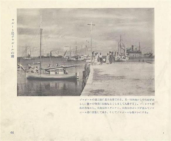
Once an important trans-Pacific airport and refueling station, Kanton declined in importance with the introduction of long-range jet aircraft in the late 1950s, and was eventually abandoned after serving a brief stint as a U.S. missile-tracking station. Today, the island still exhibits the remains of the airline and military presence, with 20 persons (as of 2016) residing there, most living in abandoned structures from the U.S./U.K. occupation (1936–1976).[2]
Most of the Phoenix Islands were annexed by Great Britain in the late 19th century, although the United States claimed Howland and Baker islands in 1935, and in 1937 Britain included the Phoenix group in the Gilbert and Ellice Islands colony. In 1938 the United States claimed sovereignty over Kanton and Enderbury, and in 1939 Britain and the United States agreed to exercise joint control over the two islands for 50 years as the Canton and Enderbury Islands condominium. This would continue until Kiribati independence in 1979.[40] Kanton was extensively developed first as a seaplane landing site, then later as a refueling station for trans-Pacific civilian and military aircraft which remained in use until 1958.
Although shelled and bombed a few times during World War II, neither Kanton nor any of the Phoenix Islands was ever occupied by Japanese forces.
In May 2010, it was reported that a British Sailor had saved a group of "desperate and starving" islanders after chancing upon them on his way to Australia. When Alex Bond, from Penryn, Cornwall, docked at Kanton Island – the only habitable island in the Phoenix Islands chain, northeast of Australia – he found that its 24 residents were destitute after a supply ship failed to bring them food four months before. He contacted the Falmouth, England, coast guard using his satellite phone, and they arranged for the U.S. Coast Guard to send supplies from Honolulu, Hawaii. The 10 children and 14 adults were surviving on fish and coconuts when he pulled into a lagoon near the small island. Bond reportedly works for U.K.-based disaster relief charity ShelterBox, which provides emergency aid to people in need.[44]
https://en.wikipedia.org/wiki/Kanton_Island
The British laid claim to Kanton Island during the 1850s.[8] The official British claim was formally reasserted on 6 August 1936, and an order in council issued in March 1937 including Kanton and other Phoenix Islands in the Gilbert and Ellice Islands Colony, with the British making several visits to the island culminating in the placement of two radio operators on Kanton on 31 August 1937.
Americans arrive
PIC: Rusting fire truck on Kanton Island, 2008.
On 8 June 1937, Kanton was the site of a total solar eclipse and the island was occupied briefly by American and New Zealand scientists, members of an expedition organized by the National Geographic Society, and led by the astronomer Samuel Alfred Mitchell. During this time, the American party claimed the island for the United States, erecting a small monument with two American flags. According to one account, the British warship HMS Wellington fired a shot across the bow of the USS Avocet, when the latter refused to cede the choicest anchorage spot to the British vessel.[16] The American ship allegedly responded in kind, following which both captains agreed to "cease fire" until instructions could be received from their respective governments. Washington and London quickly ordered no further escalation, and both parties observed the solar eclipse together, "though officially a bit cool."[17]
In response to the British reoccupation of Kanton in August 1937, seven Americans from the American Equatorial Islands Colonization Project landed on the island on 7 March 1938. Although the British ambassador to the United States requested removal of markers claiming U.S. sovereignty, President Franklin Roosevelt formally placed the island under control of the U.S. Interior department on 3 March 1938. Both parties continued to press their competing claims until 6 April 1939, when the U.S. and Britain agreed to hold Kanton under joint control for the next fifty years as the Canton and Enderbury Islands condominium. The U.S./U.K. tenure proved cordial and cooperative thereafter, with each party enjoying the other's hospitality and working together to ensure smooth operation of island facilities. An United States office was open between 1940 and 1965 and from 1970.[18] Canton Island Post Office opened on 25 January 1941 and closed around February 1968.
Pan American World Airways (Pan Am) arrived on Kanton on 18 May 1939, to build facilities for their planned New Zealand flying boat service.[8] Service commenced on 12 July 1940 with the Boeing 314 Clipper. On 4 December 1941, the Pacific Clipper departed Kanton for New Caledonia as the final civilian flight before the United States joined the war.

World War II
During World War II the United States Navy built a 6,230 foot (1.9 km) airstrip at 2°46′05″S 171°42′37″W (now known as Canton Island Airport (IATA: CIS, ICAO: PCIS)). Kanton became a stopover point for the Navy Air Transport Service flights to Australia and New Zealand as well as a staging point for attacks on the Gilbert Islands, then held by Japan. The SS President Taylor was grounded and abandoned near the island on 14 February 1942 when disembarking troops.[19] It was shelled three times in late 1942 by Japanese submarines, and bombed once on 25 March 1943. Damage was reported as "slight".[20] The island was defended by approximately 1,200 combat troops and support personnel, but was never attacked by Japanese forces.[21] It was the site of at least two airplane crashes during the war: on 19 July 1944 and 5 December 1945. After the war moved west, it became the homebase for the Roman Catholic chaplain in this area of the Pacific.[22]
Post War Administration and international airline service
In November 1946, Pan Am resumed service to Hawaii, Australia and New Zealand via Kanton with Douglas DC-4 aircraft. British Commonwealth Pacific Airlines (BCPA), Australia's first trans-Pacific airline, served the island via a cooperative agreement with Australian National Airways (ANA) initially with Douglas DC-4's on a routing of Sydney - Auckland - Fiji - Kanton Island - Honolulu - San Francisco - Vancouver, with the inaugural flight departing Australia on 15 September 1946. BCPA then began flying luxurious Douglas DC-6Bs on the Sydney to Vancouver route. Qantas took over this service shortly thereafter as BCPA subsequently ceased all operations and went out of business. Canadian Pacific Airlines also used the island as well for its Douglas DC-4 service between Vancouver and the southern hemisphere.[23] A full-scale community was established to support these airline operations, including an electrical power station, a hotel for the airline passengers' use, a medical dispensary, school for dependent children of station personnel, and other necessary facilities. The island was jointly administered by the United Kingdom and the United States, and the British and American post offices were both operated from a single building.
PIC: Pan Am Boeing 377 Stratocruiser undergoing engine repair at Kanton Island, ca. 1955 [EDITOR: Goldfinger's plane in the book]
The American administrator, who was an employee of the Civil Aeronautics Administration (predecessor to the FAA) and island manager for that agency, also served as the U.S. resident administrator under the Department of the Interior and as a U.S. special deputy marshal under the Department of Justice. William J. Evans held this position from 1952–1955, during which time a crew from National Geographic magazine visited the island and highlighted it in the magazine's January 1955 issue.[24]
Vice-President Richard Nixon and his wife visited the island in October 1953, en route to New Zealand, where they stayed overnight and were interviewed by Fred Carpenter for the local radio station KIBS.[25][26] By 1956, Pan Am was operating a Boeing 377 Stratocruiser service into the airport from Los Angeles and San Francisco, via a stop in Honolulu, with these flights continuing on to Sydney with a stop at Nadi Airport in Fiji.[27]
Ultimately, the introduction of long-range jet aircraft spelled the end of Kanton's usefulness as an aircraft refueling station, and all airlines ended their operations there by the late 1950s—except for Pan Am, which continued a monthly service with Douglas DC-7C prop aircraft via Auckland, Nadi, Pago Pago, Kanton, Honolulu and return. This service was conducted using the outbased DC-7C aircraft N743PA and N744PA, which provided feeder service from Auckland to three points on the jet service schedules. The last Pan Am flight was in November 1965 when the final DC-7C returned to Miami after the opening of a new airport in Auckland, enabling New Zealand to be added to Pan Am's Boeing 707 jet routes. Kanton's airport remained operational, however, as an emergency landing field.
https://en.wikipedia.org/wiki/Howland_Island

Not much dry land to work with!
Ground was cleared for a rudimentary aircraft landing area during the mid-1930s, in anticipation that the island might eventually become a stopover for commercial trans-Pacific air routes and also to further U.S. territorial claims in the region against rival claims from Great Britain. Howland Island was designated as a scheduled refueling stop for American pilot Amelia Earhart and navigator Fred Noonan on their round-the-world flight in 1937. Works Progress Administration (WPA) funds were used by the Bureau of Air Commerce to construct three graded, unpaved runways meant to accommodate Earhart's twin-engined Lockheed Model 10 Electra.
The facility was named Kamakaiwi Field after James Kamakaiwi, a young Hawaiian who arrived with the first group of four colonists. He was selected as the group's leader and he spent more than three years on Howland, far longer than the average recruit. It has also been referred to as WPA Howland Airport (the WPA contributed about 20 percent of the $12,000 cost). Earhart and Noonan took off from Lae, New Guinea, and their radio transmissions were picked up near the island when their aircraft reached the vicinity but they were never seen again.
A Japanese air attack on December 8, 1941, by 14 twin-engined Mitsubishi G3M "Nell" bombers of Chitose Kōkūtai, from Kwajalein islands, killed colonists Richard "Dicky" Kanani Whaley and Joseph Kealoha Keliʻhananui. The raid came one day after the Japanese attack on Pearl Harbor and damaged the three airstrips of Kamakaiwi Field. Two days later, shelling from a Japanese submarine destroyed what was left of the colony's buildings.[19] A single bomber returned twice during the following weeks and dropped more bombs on the rubble. The two survivors were finally evacuated by the USS Helm, an U.S. Navy destroyer, on January 31, 1942. Thomas Bederman, one of the two survivors, later recounted his experience during the incident in a March 9, 1942 edition of LIFE.[20] Howland was occupied by a battalion of the United States marine corps in September 1943 and was known as Howland Naval Air Station until May 1944.
All attempts at habitation were abandoned after 1944. Colonization projects on the other four islands, also disrupted by the war, were also abandoned.[21] No aircraft is known to have landed on the island, though anchorages nearby were used by float planes and flying boats during World War II. For example, on July 10, 1944, an U.S. Navy Martin PBM-3-D Mariner flying boat (BuNo 48199), piloted by William Hines, had an engine fire and made a forced landing in the ocean off Howland. Hines beached the aircraft and, though it burned, the crew were unharmed, rescued by the USCGC Balsam (the same ship that later took the USCG's Construction Unit 211 and LORAN Unit 92 to Gardner Island), transferred to a sub chaser and taken to Canton Island.[22]
https://blog.genealogybank.com/gone-the-mysterious-disappearance-of-amelia-earhart.html
Gone: The Mysterious Disappearance of Amelia Earhart
◂AllBy Gena Philibert-Ortega July 7, 2017
Editor’s Note: The world has remained fascinated by the unexplained disappearance of famed pilot Amelia Earhart, who vanished on 2 July 1937 somewhere in the Pacific Ocean while trying to fly around the world. Now, there is excited buzz at the announcement that a rediscovered photo in the National Archives may prove that Earhart and her navigator Fred Noonan survived their crash landing, only to be captured by the Japanese. This photo is featured in a new History Channel special, “Amelia Earhart: The Lost Evidence,” that airs this upcoming Sunday. See more: http://www.history.com/specials/amelia-earhart-the-lost-evidence
The Discredited Pic supposedly from 1935 and not 1937--How many Occidental Man & Woman Couples were Hanging out in Japanese-held Islands in 1937 & onwards?
Introduction: In this article, Gena Philibert-Ortega searches old newspapers to learn more about the mysterious disappearance of pioneering woman pilot Amelia Earhart, who vanished seemingly without a trace on 2 July 1937 somewhere in the Pacific Ocean. Gena is a genealogist and author of the book From the Family Kitchen.
Everyone knows about her. The life of Amelia Earhart is legend. The early aviatrix’s love of flying started with her first plane ride in 1920, and continued through flight lessons in 1921 and her role as the first female member of a flight crew to cross the Atlantic in a plane, in 1928.

Lockheed Model 10-E Electra
Photo: Amelia Earhart standing under nose of her Lockheed Model 10-E Electra – the plane she was flying when she mysteriously disappeared. Credit: Wikimedia Commons.
Her life was full of firsts, but she wanted more: more challenges, more new or broken records, more flying. Her attempt in 1937 to be the first woman to fly around the world would prove to be her last – but that one singular attempt has captivated everyone’s imagination for 80 years, due to her mysterious and still unexplained disappearance.
In 1937, 29,000 miles seemed like a good challenge for the 39-year-old aviatrix, who was joined on her attempted record-setting flight by navigator Fred Noonan. They were flying a specially-modified Lockheed Electra 10-E airplane built to Earhart’s specifications. Her first attempt at the record had to be scrapped due to mechanical problems, but she nearly made it on her second try.
Illustration: Amelia Earhart’s Lockheed Model 10 Electra, at Oakland, California, on 20 March 1937. Credit: United States Air Force; Wikimedia Commons.
That second attempt saw her take a route from west to east, flying 22,000 miles with stops in South America, Africa, the Indian Subcontinent, and Southeast Asia. On 29 June 1937, she landed in New Guinea. She had 7,000 miles to go – but those remaining miles were all over the Pacific Ocean.*
Disaster Strikes
On July 2nd Earhart and Noonan departed Lae, New Guinea, en route to Howland Island. Despite some inclement weather, Earhart and Noonan appeared to be getting close to the small island where they wanted to land. At 6:14 a.m. she radioed the USCGC Itasca stationed at Howland Island to say she estimated she was 200 miles away. Then at 6:45 a.m. she reported she was just 100 miles from Howland Island.
At 7:42 a.m., the Itasca picked up a message: “We must be on you, but we cannot see you. Fuel is running low. Been unable to reach you by radio. We are flying at 1,000 feet.” At 8:43 a.m. Earhart made what is believed to be her last radio transmission when she said: “We are running on line north and south.”** Not only was Earhart losing radio contact with the Itasca, her plane was running out of gas.
She was [allegedly] never heard from again, and no wreckage from her plane has [yet] ever been found.
As soon as the news broke of Earhart’s disappearance, newspapers wasted no time publishing articles detailing everything known about the missing plane and her crew. Articles blanketed multiple pages of daily newspapers reporting everything from interviews with friends and family of Earhart and Noonan, to facts about her plane and the flight plan, to the rescue attempts.
An article about the disappearance of famed woman pilot Amelia Earhart on 2 July 1937, Seattle Daily Times newspaper article 3 July 1937

Seattle Daily Times (Seattle, Washington), 3 July 1937, page 1
In addition to a front page article, the 3 July 1937 issue of the Seattle Daily Times had two pages devoted to articles about Earhart, Noonan, and the search. As you can imagine, great hope existed in those first few days after Earhart’s plane disappeared.
An article about the disappearance of famed woman pilot Amelia Earhart on 2 July 1937, Seattle Daily Times newspaper article 3 July 1937
Seattle Daily Times (Seattle, Washington), 3 July 1937, page 3
While official channels were monitoring the radio transmission of Earhart, so too were amateur radio enthusiasts. The article “Navy Plane Speeding to Aid Search at Howland” mentions that on the day of her disappearance, in addition to the Coast Guard and Pan American Airways, amateur radio operators were following Earhart’s radio. This was a rescue effort that many, both government and civilians, felt a part of.
There was hope in those first hours and days after the disappearance. Maybe she landed the plane on a neighboring island or was floating in the ocean (or Earhart and Noonan were aboard the inflatable boat they carried with them). Earhart’s husband, the publisher George Palmer Putnam, remarked: “The plane should float, but I couldn’t estimate for how long because a Lockheed plane has never been forced down at sea before.” Earhart had other emergency supplies with her including life belts, flares, signal kit, and food and water.
As those early newspapers articles speculated as to where Earhart was, civilians had their own theories. Charles Randolph, Jr., a 12-year-old boy from Wyoming, reported picking up a faint radio transmission that said “Amelia Earhart calling… ship on reef south of the equator” on the morning of 5 July 1937. The newspaper Times-Picayune reported that an air official said the report was “plausible and not improbable.” That boy’s report of hearing Earhart’s faint voice over the radio waves was one of many that were most likely not Earhart, but instead wishful thinking.
An article about the disappearance of famed woman pilot Amelia Earhart on 2 July 1937, Times-Picayune newspaper article 5 July 1937
Times-Picayune (New Orleans, Louisiana), 5 July 1937, page 1
The Search
The Coast Guard cutter Itasca, in charge of providing radio and air navigation support, started the initial search for Earhart’s plane. However, by the afternoon of July 3rd it reported that it had scanned 3,000 square miles of ocean and had not seen any sign of the aviatrix, her navigator, or their plane. Help was on its way to increase the search, including the aircraft carrier Lexington, which was sent from San Diego, California.
An article about the disappearance of famed woman pilot Amelia Earhart on 2 July 1937, Idaho Statesman newspaper article 4 July 1937
Idaho Statesman (Boise, Idaho), 4 July 1937, page 1
The search continued for two weeks, but no matter how many Soldiers, ships, and planes scanned the ocean and nearby islands, nothing was found and hope changed to dread. On July 16th, the newspaper reports mirror the loss of hope of those who were searching in vain.
For example, the following Times-Picayune article starts out commenting on the 1500 “sweltering Sailors” laboring on the search and explains that “Forty-two planes again left the decks of the aircraft-carrier Lexington for their third sweep of the equatorial seas about Howland Island. Three and one-half hours later the air fleet returned, empty-handed as usual, to the Lexington.”
An article about the disappearance of famed woman pilot Amelia Earhart on 2 July 1937, Times-Picayune newspaper article 16 July 1937
Times-Picayune (New Orleans, Louisiana), 16 July 1937, page 3
After spending 17 days searching over 250,000 square miles of ocean, on July 19th the search was declared over.*** The San Francisco Chronicle’s front page declared “Navy Gives Up Its Hunt for Amelia.” Admiral Orrin G. Murfin, commander of the Fourteenth Naval district, reported that:
“We have covered all possible territory… some of it we have been over as much as three times. I could not conceive of any other place where we might direct our search, and obviously we can’t keep it up indefinitely. We feel that we’ve done everything possible now.”
A search that included the Itasca, the mine sweeper Swan, the USS Lexington, and 62 of its planes was over. Amelia Earhart and her navigator Frederick Noonan were considered dead.
An article about the disappearance of famed woman pilot Amelia Earhart on 2 July 1937, San Francisco Chronicle newspaper article 19 July 1937
San Francisco Chronicle (San Francisco, California), 19 July 1937, page 1
The Mystery Continues
The mystery of what happened on 2 July 1937 still intrigues those who love history, and Amelia Earhart’s many fans. Numerous books and research trips are part of the continuing efforts to try to answer the question of what really happened that July morning. Did Earhart and Noonan drown in their plane that plunged to the ocean floor, or did she land on a neighboring island waiting for the rescue that would never materialize? Was she captured by the Japanese who executed her for being a spy?
Like most lovers of history, I hope that one day we learn the truth about what happened to Amelia – but I also believe it’s important to remember her for more than just her disappearance. Ultimately, Amelia Earhart wanted to show the world that women were the equals of men.
Before her 1928 Atlantic flight she wrote:
“I have tried to play for a large stake. If I succeed, all will be well. If I don’t I shall be only too happy to bop off in the midst of such an adventure.”
Note: An online collection of newspapers, such as GenealogyBank’s Historical Newspaper Archives, is not only a great way to learn about the lives of your ancestors – the old newspaper articles also help you understand American history and the times your ancestors lived in, and the news they talked about and read in their local papers.
———————–
* “Amelia Earhart,” Wikipedia (https://en.wikipedia.org/wiki/Amelia_Earhart: accessed 5 July 2017).
** “Biography,” Amelia Earhart (http://ameliaearhart.com/biography/: accessed 5 July 2017).
*** Ibid.
Related Article:
20 May 1932: Amelia Earhart’s Solo Flight across the Atlantic
Bobby joe says:
October 9, 2017 at 3:14 pm
🙂 Love it
Reply
David Billings says:
January 1, 2018 at 9:17 pm
Gena,
Your readers may like to read further on the subject and read about my project group which searches for an aircraft wreck in the jungle in New Britain Island. We do have evidence…. see: http://www.earhartsearchpng.com
Regards,
David Billings
Nambour
Queensland
Australia
Reply
Gena Philibert-Ortega says:
January 2, 2018 at 12:20 pm
David, thank you for providing your website address and your research. I appreciate it!–Gena
Reply
Robert Grant Wealleans says:
October 15, 2019 at 1:23 pm
Dear Gena Philibert-Ortega,
You might be interested in my research and a possible image of her plane in a 1940 and a 1941 photo taken of the SS Norwich City on Gardner Island (aka Nikumaroro). Especially since Ballard was there recently. As far as I know, judging by the controversy raised by active Earhart searchers, no one spotted this almost ghostly image in the surf-line. It’s being dismissed as an illusion of water and reef even though this same object with its distinctive features described by me is seen further up-reef in a 1941 photo. My own theory is that the Electra washed further out onto the extensive reef, breaking off a landing wheel or more in the process. Then, it migrated in the prevailing longshore drift to wash up in the lee of the shipwreck some three and a half years later (600 meters south and west of the “landing gear” found in a 1937 photo). Ballard said he learned a lot from studying the debris flow from the shipwreck and wants to return if definitive proof she landed there is forthcoming. He did not search all the way to the ocean floor nor did he search the lagoon. I sent him my stuff to the Univ of RI website but have not heard back. My theory is that a lot of the plane is in the lagoon covered with 70 years of silt. Even natives who lived there from 1938-1963 report airplane parts washing up, including a wing, in the lagoon.
Look at that image nearr the stern, partially submerged in shallow water.
I’ve got more if you are interested.
I’m a retired immigration lawyer/author living in Novato, CA (nr SF).
https://www.portnews.com.au/story/2771876/fijis-flight-into-aviation-history/
DECEMBER 20 2014 - 4:00AM
Fiji’s flight into aviation history
Malcolm Andrews
Latest News
Comments
Idyllic: Fijian airline had its beginnings on Katafanag Island. Pic: Katafanga Resort+
THERE were some real 'cowboys of the air' in the early days of flying in the Pacific islands. Some had little, if any, flying experience before jumping into primitive aircraft and island-hopping with fare-paying passengers.
The poor old passengers had never been in a plane before, so they wouldn't have known they were taking their lives into their hands.
A bloke called Fleming - no one knows much about him, not even his Christian name - was the first. He built the plane himself in 1922 - in his backyard in Suva.
The good Mr Fleming is believed to have crashed out very early in his aviation career.
Then, at the start of the 1930s, a ships captain turned aviator, Gordon Fenton, had a British-built Simmonds Spartan biplane shipped to Fiji by sea.
Its assembly was haphazard and apparently at first the wings were put on back-to-front.
It took Fleming some time to work out why it was having trouble getting airborne.
A friend checked the assembly instructions, worked out the mistake, and Captain Fenton was off and flying.
He would fly the 180 kilometres between the capital Suva in the southeast and Lautoka in the west in one hour and 35 minutes.
Local businessmen were impressed and began using Captain Fenton regularly.
He reckoned he was on a gold mine. He set up the first Fiji Airways in 1933, but fell victim to the Great Depression and the airline soon folded.
Like with so many larger-than-life South Pacific figures, stories abound concerning Captain Fenton.
One is that he would test pilots looking for jobs by asking them to fly under the 'Penny-farthing' Bridge on the Rema River near Suva ? at high-tide.
There was not a lot of room and only the most daring of airmen would even attempt such a feat.
About the same time as the airline was being set up, another local enthusiast, building contractor Alf Marlow, imported the first of three 1922 Dormier Libelle flying boats from Germany.
There were many stories told about Marlow, too.
It was said that sometimes he would get tired of flying the route from Suva to Lautoka and would land his aircraft on top of a train owned by the Colonial Sugar Refinery, taking cane from Sigatoka.
A seaplane? As the proverb says - pigs might fly but they are very unlikely birds.
But then along came a bloke who actually knew what he was doing.
He was a brilliant pioneer Australian aircraft navigator, Harold Gatty, who was given a ticker-tape parade in New York City in 1931 with another intrepid aviation trail-blazer, Wiley Post, for their record round-the-world flight.
In a Lockheed Vega they flew around the globe in 8 days, 15 hours and 15 minutes, beating the previous record by more than 12 days.
The following year the U.S. Congress passed a special bill so the Australian could be awarded America's Distinguished Flying Cross.
Another measure was passed to allow President Herbert Hoover to appoint Gatty to a senior government role after the aviator had refused to give up his Australian citizenship and become an American.
During the war he worked under General Douglas MacArthur as director of Allied transport in the South-West Pacific before being transferred to the U.S. Navy to work on polar navigation.
After the conflict ended, Gatty settled in Fiji.
Gatty's airline started out as Katafanga Estates Airways as its headquarters was on Katafanga island which Gatty had bought on the eastern Fijian coast. But the name was soon changed to Fiji Airways.
Its first flight was on September 1, 1951, with a seven-seater De Havilland Dragon Rapide flying between Nausori and Lautoka.
There was a further name change to Air Pacific, but in May 2012 the company reverted to the former name of Fiji Airways.
And, as the clich tells us, the rest is history.
This year, for the first time Fiji Airways will carry more than one million passengers on international flights in a calendar year.
Tomorrow one passenger flying out of Nadi Airport will be feted as the millionth, and lavished with special souvenirs of the occasion.
In addition, he or she will be given a free ticket to the overseas destination of his or her choice.
Bula!

IF the U.S. ARMY would stop cowering before USAF flyboys they'd have helicopters that convert into fixed-wing planes to safely self-deploy across Oceans
.jpg)

Comments
Post a Comment